Log in
All resources
Create a design
265 Free Images of Maps Of Norway
atlas maior, vol 1 (northern europe, norway, and denmark) - joan blaeu, 1667 - bl 114.h(star).1
copper engraving print
british library
joan blaeu
1667 maps
bibliothèque nationale de france
fondo antiguo
cartography
engraving
noruega
atlas maior, vol 1 (northern europe, norway, and denmark) - joan blaeu, 1667 - bl 114.h(star).1
1667 maps
atlas maior, vol 1 (northern europe, norway, and denmark) - joan blaeu, 1667 - bl 114.h(star).1
1667 maps
atlas maior, vol 1 (northern europe, norway, and denmark) - joan blaeu, 1667 - bl 114.h(star).1
1667 maps
atlas maior, vol 1 (northern europe, norway, and denmark) - joan blaeu, 1667 - bl 114.h(star).1
1667 maps
atlas maior, vol 1 (northern europe, norway, and denmark) - joan blaeu, 1667 - bl 114.h(star).1
1667 maps
atlas maior, vol 1 (northern europe, norway, and denmark) - joan blaeu, 1667 - bl 114.h(star).1
1667 maps
atlas maior, vol 1 (northern europe, norway, and denmark) - joan blaeu, 1667 - bl 114.h(star).1
1667 maps
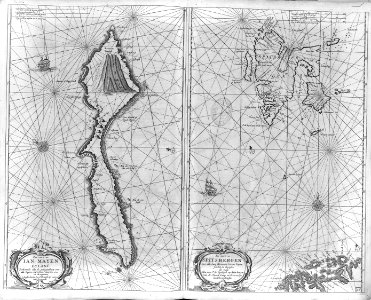
old maps of finnmark
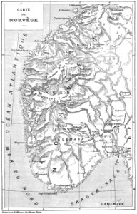
1890s maps of norway
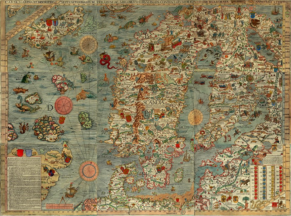
1590s maps of the world
cornelis de jode
maps of bergen (norway) by braun & hogenberg
bibliothèque nationale de france
cartography
maps
atlas maior, vol 1 (northern europe, norway, and denmark) - joan blaeu, 1667 - bl 114.h(star).1
1667 maps
atlas maior, vol 1 (northern europe, norway, and denmark) - joan blaeu, 1667 - bl 114.h(star).1
1667 maps
atlas maior, vol 1 (northern europe, norway, and denmark) - joan blaeu, 1667 - bl 114.h(star).1
1667 maps
atlas maior, vol 1 (northern europe, norway, and denmark) - joan blaeu, 1667 - bl 114.h(star).1
1667 maps
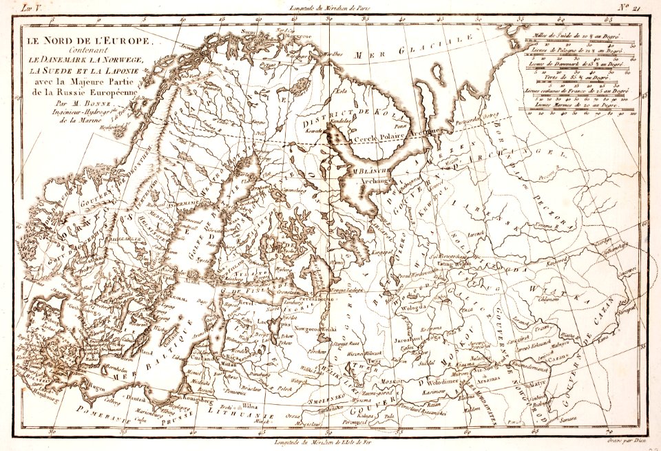
old maps of norway
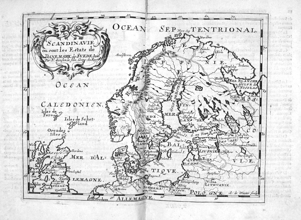
guillaume sanson
cartography
maps
maps of bergen (norway) by braun & hogenberg
hieronymus scholeus
voyages de la commission scientifique du nord, en scandinavie, en laponie, au spitzberg et aux feröe
19th-century maps of norway
atlas maior, vol 1 (northern europe, norway, and denmark) - joan blaeu, 1667 - bl 114.h(star).1
1667 maps
atlas maior, vol 1 (northern europe, norway, and denmark) - joan blaeu, 1667 - bl 114.h(star).1
1667 maps
maps of the arctic by gerardus mercator
maps by hendrik hondius the younger
cartography
maps
old maps of norway
guillaume sanson
admiralty charts region d: eastern north sea baltic norway iceland faroes svalbard
admiralty charts 3001-3400
atlas maior, vol 1 (northern europe, norway, and denmark) - joan blaeu, 1667 - bl 114.h(star).1
copper engraving print
atlas maior, vol 1 (northern europe, norway, and denmark) - joan blaeu, 1667 - bl 114.h(star).1
copper engraving print
atlas maior, vol 1 (northern europe, norway, and denmark) - joan blaeu, 1667 - bl 114.h(star).1
copper engraving print
atlas maior, vol 1 (northern europe, norway, and denmark) - joan blaeu, 1667 - bl 114.h(star).1
copper engraving print
atlas maior, vol 1 (northern europe, norway, and denmark) - joan blaeu, 1667 - bl 114.h(star).1
copper engraving print
atlas maior, vol 1 (northern europe, norway, and denmark) - joan blaeu, 1667 - bl 114.h(star).1
1667 maps
old maps of vardø
guillaume sanson
old maps of vardø
guillaume sanson
maps by willem and johannes blaeu
1630s maps of the world
old maps of norway
guillaume sanson
old maps of norway
guillaume sanson
atlas maior, vol 1 (northern europe, norway, and denmark) - joan blaeu, 1667 - bl 114.h(star).1
1667 maps
atlas maior, vol 1 (northern europe, norway, and denmark) - joan blaeu, 1667 - bl 114.h(star).1
1667 maps
atlas maior, vol 1 (northern europe, norway, and denmark) - joan blaeu, 1667 - bl 114.h(star).1
copper engraving print
atlas maior, vol 1 (northern europe, norway, and denmark) - joan blaeu, 1667 - bl 114.h(star).1
copper engraving print
maps by willem and johannes blaeu
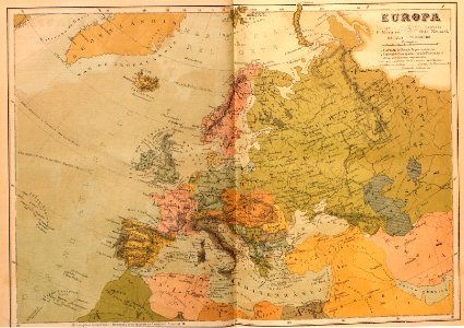
17th-century maps of europe
cartography
maps
views of oslo from ekeberg
franz šedivý
den danske hærs historie til nutiden og den norske hærs historie indtil 1814
maps of battles of sweden
a class-book of modern geography (1898)
maps of sognefjorden
cartography
maps
cartography
maps
die zee custe van noorweghen tusschen der noess ende mardou, soe tzelfde landt aldaer in zijn wesen ende ghedaente is - (lucas ioannes aurigarius inventor) ; ioannes à doetecum fecit - btv1b532358494
bibliothèque nationale de france
die zee custe van noorweghen tusschen der noess ende mardou, soe tzelfde landt aldaer in zijn wesen ende ghedaente is - (lucas ioannes aurigarius inventor) ; ioannes à doetecum fecit - btv1b532358494
bibliothèque nationale de france
die zee custe van noorweghen tusschen der noess ende mardou, soe tzelfde landt aldaer in zijn wesen ende ghedaente is - (lucas ioannes aurigarius inventor) ; ioannes à doetecum fecit - btv1b532358494
bibliothèque nationale de france
cartography
maps
lucas janszoon waghenaer
1588 maps of norway
travel
maps
historical
history
cartography and geographical illustrations of the wehrmacht
trondheim in the 1940s
civitates orbis terrarum. urbium praecipuarum totius mundi. liber quartus
maps of bergen (norway) by braun & hogenberg
old maps of stavanger
old maps of rogaland
historical images of trondheim
det gamle throndhjem (1897)
maps of the arctic ocean
atlas novus (blaeu)
old maps of møre og romsdal
stadlandet
roman
maps
historical
history
map of europe by guillaume delisle (1700)
university of washington
recherchefjorden
1876 in norway
thomas onwhyn
britannia
201 - 265 of 265
/ 3


!["Descriptio Vorticis Noruegiae et Bodniae eorumq[ue] mirab…](https://cdn.creazilla.com/illustrations/5593800/descriptio-vorticis-noruegiae-et-bodniae-eorumq-ue-mirab-illustration-md.jpeg)